DAY 1: USHUAIA (54°56'S / 67°36'W)
The group will board in Ushuaia (Arg.), and all entry and exit formalities will be handled.
Introduction to life on board: Functioning of the salt and fresh water inlets and outlets, onboard electronics,
Sailing techniques, anchoring maneuvers, weather conditions, safety measures, route description, classification of
Watch crews and other duties on board. Sailing on the Beagle Channel to Puerto Williams
PUERTO WILLIAMS
We dock in Seno Lauro at the Micalvi, a scrapped Chilean naval vessel that was used as
Yacht mooring and harbor bar are in operation. Seno Lauro is one of the best natural harbors in the area, with views.
to the snow-covered, bizarre peaks of the Dientes de Navarino.
At the Hosteria WALA, which is mainly furnished with Yamasan handicrafts, we can
perhaps enjoy our first centollas (king crab). (The Fuegian Indians around Cape Horn were
called Yamanas). Last endless showers on board.
2nd/3rd DAY: CALETA MARTIAL (55°50'S / 67°18'W)
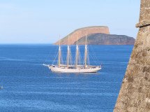
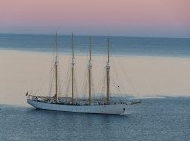
Today we will conquer Cape Horn – by sailing. We will round the northern part and reach Isla de Hornos.
the Pacific Ocean and then turn east. To port we see the cliffs of Cape Horn, which rise steeply,
They seem unapproachable and unconquerable. Here the Pacific and Atlantic Oceans meet, a fact that
which can easily cause rough seas.
The classic view of Cape Horn is the steep cliff of the southern cape. Far below its summit still stands the old lighthouse, whose faint light I saw in 1977 – but today it shines no longer beneath the clouds. On exposed rocks, a mile offshore, the sea breaks heavily even on a calm day, as waves roll in from the Southern Ocean and pile up on the shallow shelf water 75 miles southwest of here. (Skip Novak: “Cape Horn in Mysterious Veils”). We make final contact with the lighthouse keepers by radio.
They will relay to Naval Headquarters in Puerto Williams that we have rounded Cape Horn. Time for
A glass of champagne – we made it! As soon as we were in the lee of the Hermite archipelago…
Once we reach calmer waters, we will return to calmer waters.
Isla Hornos is only 9 km long and 500 meters high. The island is part of the Hermite group and is typical of
the vegetation and fauna of this region.
With a bit of luck, we might see whales, Commerson's dolphins, and Dusky dolphins. The Totorore expedition named a bay on Herschel Island "Caleta Tonina" because dolphins are always found there. On the nearby islands, some of the beaches are...
Besieged by seals. Mollymauk albatrosses, giant petrels, cormorants, wild geese,
Skuas rule the skies.
We relive the experiences of other sailors rounding Cape Horn. Most of them
Single-handed sailors were glad if they didn't even see the cape; too much proximity to land is oppressive. Or
Fog obscured the view. How many didn't need to use their engines to get around the cape...?
Cape Horn - Cape of Extreme Challenges - of many fates and despairs - Cape of many
Sailors who lost their lives here – a symbol of the end of the world
In 1616, Le Maire and van Schouten discovered this on their Dutch expedition ship, the "Eendracht".
Cape, and thus a new sea route to India. They named the cape after their [unclear] a few weeks ago.
the lost ship, the Hoorn, and its home port, Hoorn on the Zuiderzee. Homesickness was also present.
This is probably not unfamiliar to these captains.
In good weather, we can anchor in Caleta Leòn and visit the lighthouse keeper of Cape Horn.
A Chilean family is chosen to guard the lighthouse on Isla for one year at a time.
Hornos is stationed here. They live here together with some dogs in a tin shack.
There is a chapel and
A post office hut where you can also sign the guestbook. For several years now, it has also been a stop there.
The French monument honoring the Cape Horn sailors stood against the endless storms.
We can watch the enormous oceanic water masses drifting towards us and from
whom we can assume have never seen anything other than Cape Horn or Antarctica
have received, because there is no further land on their journey around the Earth.
The view is breathtaking: in front of us lies the Drake Passage and behind us the enormous 3000-meter-high Darwin Tower.
Mountain range. These snow-covered peaks mark the beginning of the Andes, which extend through Venezuela.
the entire South American continent.
In calm weather we can spend the night in Caleta Hornos, moored to the marine buoy; otherwise
We retreat to Caleta Martial.
DAY 4: PUERTO TORO (55°05'S / 67°06'W)
Puerto Toro (30 nautical miles (SM)), the southernmost human settlement on Earth with approximately 50 men and women
and children. Here, on our last visit, we met the outgoing Chilean president.
who was just paying his farewell visit. Who knows, maybe we'll get lucky again.
We will try to exchange several buckets full of Centollones (King Crab) or Centollones (False King Crab) for
to exchange a bottle of whisky, so that the next few dinners will be taken care of.
DAY 5: PUERTO WILLIAMS (54°56'S / 67°36'W)
Arrival in Puerto Williams, last chance for an excursion to some beaver dams or up to Pico
Navarino, which offers a magnificent view of the Beagle Channel. Or we make our way through the thick of the Patagonian forest, searching for the "pan dos Indios." These are fungus-like parasites on the
Trees that were formerly gathered by Native Americans for food. This vegetation forms
Growths form on the trunks and branches, which can be removed after the bark is removed (by boiling for several hours).
to reveal the most bizarre forms.
USHUAIA
Final departure formalities, last time on the Beagle Channel with Isla dos Lobos: sea lions, fur seals and
Cormorants.
Read more